Louisiana report: Wilson’s Plovers and why we monitor them (slideshow)
By Hugh Powell
June 26, 2010
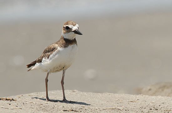
Wilson's Plovers nest on barrier beaches in the southern US and Caribbean 
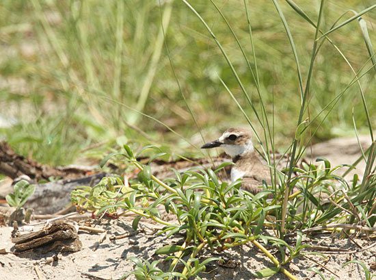
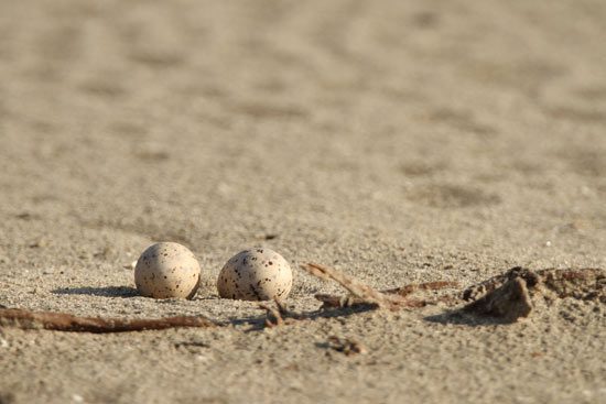
Their nests are typically a simple scrape in the sand 
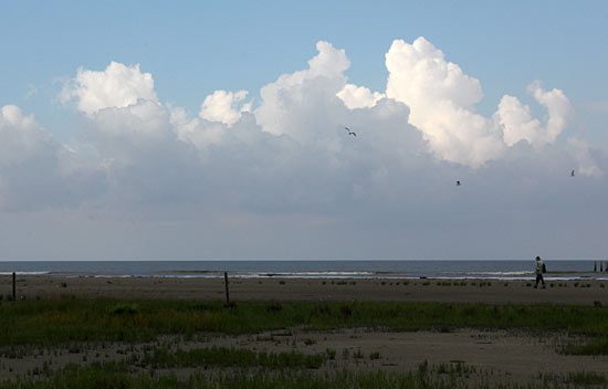
I joined a survey for Wilson's Plovers and other species on the Chaland Headland 
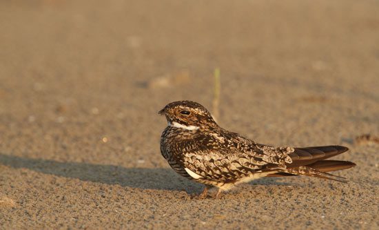
Common Nighthawks nest in high numbers along these barrier beaches 
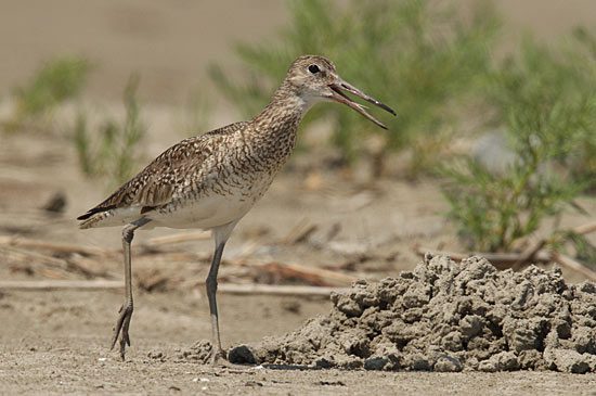
Willets are another common beach-nesting bird here 
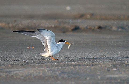
Least Terns nest in loose colonies on the dry sand of flat, upper beaches 
Like the Wilson's Plovers, their nests are extremely hard to see 
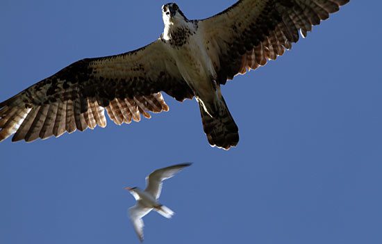
At Grand Isle the day before, we had seen eight Least Terns mob this Osprey at once 
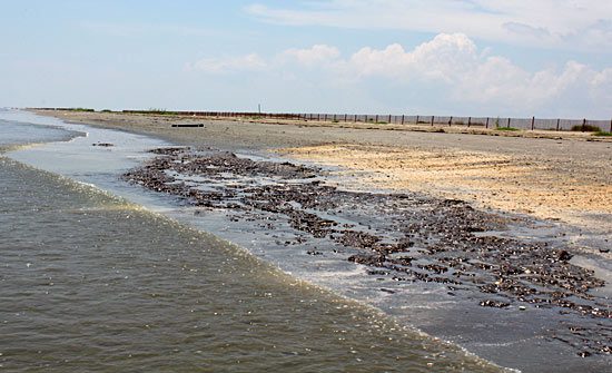
A shelf of old but still toxic oil sinks into the sand 
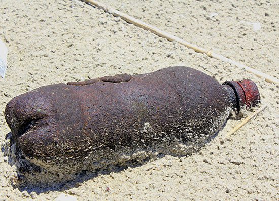
An oil-soaked discarded bottle illustrates both end points of our petroleum-pollution problem 
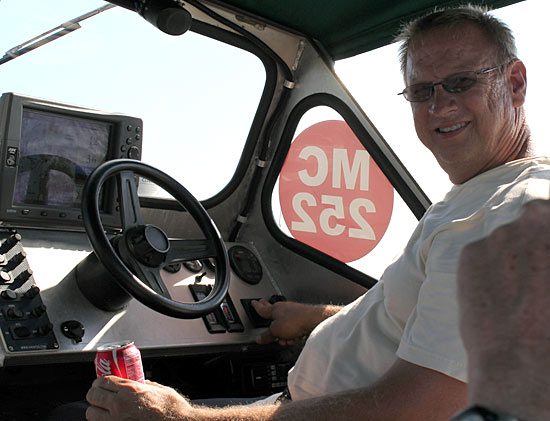
Thanks to Richard DeMay, of the Barataria-Terrebonne National Estuary Program... 
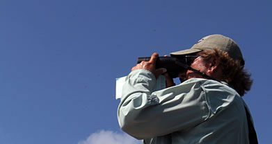
and to LSU's Steve Cardiff (scanning for oiled birds), for allowing me to participate
I spent Thursday looking for Wilson’s Plovers under the baking sun on a barrier island east of Grand Isle. I was with a survey team led by Richard DeMay, of the Barataria-Terrebonne National Estuary Program, and Steve Cardiff, of Louisiana State University. I’m grateful to them for the chance to see first-hand the unique threats to and successes of beach-nesting shorebirds in Louisiana.
One of the first things I had to learn about Wilson’s Plovers was how to see them. Cardiff showed me the ropes, pointing out three superbly camouflaged pairs almost as soon as we got off the boat. We were on the Chaland Headland, a quarter-mile-wide, three-mile-long beach flecked with shells and sprigs of pickleweed. Somewhere in that expanse were a few dozen little seven-inch shorebirds the color of sand.
A stream of quiet, brittle whistles was the first hint that anything was alive out in the heat shimmer. Slowly my eyes began to make pieces of plovers into a whole: the dun-colored triangle of wings and tail; the rounded knee-shape of a plover’s head on lookout; the vertical line of white and brown that runs down the neck.
The plovers were numerous here. Unlike many shorebirds, which breed in the far north, Wilson’s Plovers breed on southern U.S. and Caribbean beaches; they spend winters in Central and South America. The Gulf Coast is home to about 60 percent of North America’s estimated 12,250, making Wilson’s Plovers one of the highest-concern beach-nesting shorebirds in the path of the oil.
These Wilson’s Plovers were nesting on sand-and-shell flats kept dry by virtue of being six inches higher than their surroundings. Males make a few three-inch-wide scrapes in the sand and, if a female finds one she likes, she may lay an egg there the same day. Later, parents may use the other scrapes as decoys to lead away predators.
Though the birds nest fairly far above the high-tide line, they forage in marshes and tide-covered mudflats. They eat mainly fiddler crabs, which they seize in their bullet-shaped black bills, shaking off each leg one by one and then swallowing the carapace whole. Their entire foraging strategy lies within the path of oil.
When they’re concerned, Wilson’s Plovers make a sharp, ascending whistle, often while flying a few feet over the sand. Whenever I saw this—or noticed Least Terns scolding me from above—I stopped looking around. The only way to be sure I didn’t step on a nest was to look at each footstep until I had left the birds behind. Though these birds as well as Common Nighthawks and Willets nest here by the dozens, I never saw a nest. (Cardiff found several and recorded the GPS coordinates of each.)
It took us about five hours to canvass the headlands, and by the time we finished, at two, I felt like I had been wrapped in hot towels. As I walked along the shoreline, I came across a hardened patch of oil about 20 yards long. Waves had shaped it into a pitted shelf and had begun to cover the edges with sand. The oil seemed as if, after enjoying a brief release from the earth, it was reverting to geology. But this oil will remain toxic even if it disappears.
Once sand buries the oil below the reach of surface oxygen, oil-eating bacteria will be unable to work on it. Burrowing worms and mussels will ingest it and, because they can’t process the toxins, will store them in their tissues. Through the food chain, this buried oil will slowly but continually work its way back into our world. Twenty years after the Exxon Valdez spill, scientists are still seeing this effect, particularly in Harlequin Ducks that feed on mussels in Prince William Sound.
It’s a depressing setback for attempts to stem that other coastal Louisiana disaster, the erosion and subsidence of wetlands. Much as Capt. Iverson had done at the Iron Banks, Cardiff pointed toward the bay and said, “The reason this is called Chaland Headland is because there used to be marsh all the way up here. This wasn’t an island until recently.”
As the land sinks, storms and hurricanes take larger bites out of marshes and beaches. Storm surges slice channels across barrier islands and then erosion eats at them from all sides. The island shrinks like a melting ice cube.
To fight the decline, agencies dredge sand from deeper waters. They pile it in the channel cuts to close them off. Bulldozers spread the sand, widening the beach, and workers plant beach vegetation. Shorebirds like Wilson’s Plovers and Least Terns have responded well to this sudden appearance of new habitat.
It was this beach-building, not the oil, that prompted DeMay’s and Cardiff’s surveys. They conduct plover surveys in summers and winters, as budgets allow, so that they can understand how populations change as the beaches change. Like most monitoring work, it’s chronically underfunded: the survey team is at least half volunteer and relies on DeMay’s ability to free up boat time (most beaches are inaccessible by car).
The pricelessness of monitoring data is never apparent except in hindsight. But to understand a catastrophe, we need to know what happened leading up to it, not just what happens afterward. It’s why banks have security cameras and airplanes carry black-box recorders. Without ecological monitoring systems for each ecosystem we care about, the answers we need will stay as hidden as a Wilson’s Plover in the sand.
Images by Benjamin Clock except #3 and 9-12, by Hugh Powell. In addition to Richard DeMay and Steve Cardiff, thanks also to the other surveyors, Donna Dittman, Mac Myers, and Melvin Weber.
New development: The eBird team has scrambled to make it easier to report baseline shorebird data in the days since the oil spill. They’ve released a new version of the eBird Gulf Coast Oil Spill Tracker that overlays a map of the spill extent and spill forecasts against recent sightings of 10 vulnerable coastal species. See it here.

All About Birds
is a free resource
Available for everyone,
funded by donors like you
American Kestrel by Blair Dudeck / Macaulay Library
